| Connects to: Hay Canyon Trail |
At a Glance:
Nearest Town: Whitehall Open Dates: All Year
Class Trail: 2.5 Length: 13 miles from hwy 2 to Hay Canyon Trail intersection additional 7 miles to Whitetail Road
High-Clearance?: Yes Wide/Long Vehicles: Use Caution
|
The Beaverslide Trail is a short trail that intersects with the Hay Canyon Trail (See Hay Canyon Trail discription) about 9 miles from the parking area at the trailhead at the Whitetail Road. It features some great scenery, a coupkle so reather steep, rocky hills and some twists and turns in the trees.
Of course, you can travel this trail either direction but, for our purposes here, I am going to start from the Whitehall side.
We start at the intersection of Sheep Camp Road and Hwy 2. The intersection is about 3.6 miles west of Whitehall, or, if comming from the west it is also 3.6 miles from the Pipestone exit to the intersection with Sheep Camp Road.
|
 |
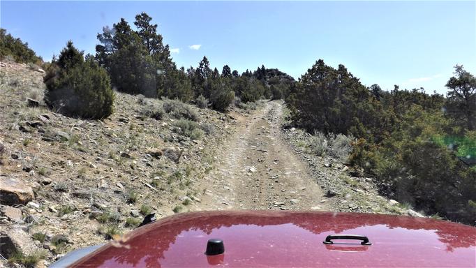
| This is not the steep spot. |
|
|
From Whitehall, head west on Hwy 2 to the Sheep Camp intersection. From the Pipestone exit, take Pipestone Road heading east to Hwy 2. Turn left (toward Whitehall) and the intersection with Sheep Camp Road is less than 1/2 miles more.
The coordinates to this intersection are: 45°52'57.8"N 112°10'42.0"W or 45.882712, -112.178328. For a Google Maps pin (**CLICK HERE**)
|
 |
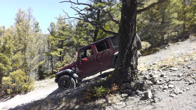
| What a great view. |
|
|
Head north on Sheep Camp Road. An intersection at about 1.9 miles from the HWY 2 intersection, just after a left curve, we want to go right. Both direction are Sheep Camp Road so watch for the turn. From that turn, just follow the main trail. At a bit over the 4 mile mark, you will come to Little Whitetail Creek. but we are not crossing the creek here. It is a nice spot to stpo for a small rest and to run the dongs and kids. Butour trail bares to the left running parrallel to the creek in a northwesterly direction. Go another mile to cross the creek.
|
 |
| Crossing Little Whitetail Creek |
|
|
Just stay on Forest trail NF-8600 until you come to a clear intersection at the Hay Canyon Trail (Little Whitetail Road). From her, you can go right to go to the Whitetail Road (that runs between Boulder and Whitehall) or you can go right to head towards the Pipestone OHV area and eventually the 4 Corners Parking area there. Ringing Rocks is also that direction.
|
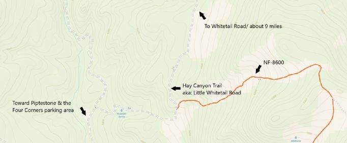 |
| The intersection of Beaverslide Trail with the Hay Canyon Trail |
|
|
Coordinates to this intersection are: 46°01'37.5"N 112°11'50.5"W46.027078, -112.197346 or for a Goole Maps pin to this spot: (**CLICK HERE**)
|
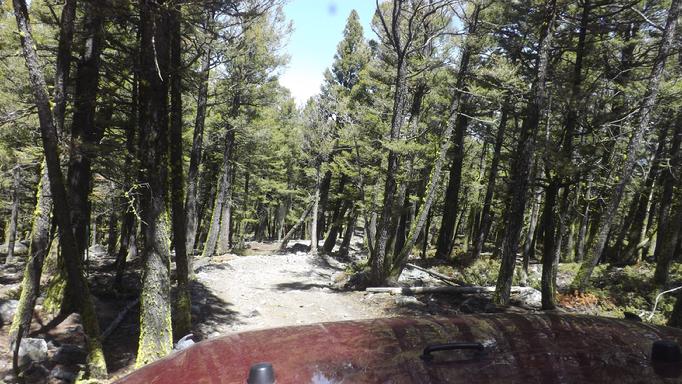 |
| Heading into the twists and trees. |
|
|
NOTE: We are simply describing a 4x4 route. We accept no responsibility for your decisions. 4x4 off-roading can be great fun but it can also be dangerous. People can get hurt and vehicles can get stuck and/or damaged. Trail conditions can, do, and will, change at any time. Road conditions may no longer be accurately reflected in this or any trail description. Only you can decide what trails or obstacles your experiance and vehicle can safely navigate. When in doubt, turn around. Wheel Safe!!
|
|