| That Blog Kind Of Thing... |
I (Richard) had a great time leading yesterday's Frontier 4x4 Club trail ride to the Whitetail Reservoir. Daryl joined as well. (Joe was heading back from a Jeep Jamboree.)
We had 14 rigs with people from Helena (of course), Townsend, several from Great Falls, and even a FS firefighter from Utah, who has been working in this area. It was a really fun group of people.
This is always an interesting trail but the old bridge over Halfway Creek and some very slick mud would turn into the real challenge on this trip. It made for a very interesting day.
Several wheelers got to use their winches for the first time ever. Some experienced the benefits of traction boards for the first time and several people (from another group) learned the magic of a kinetic rope. At least one SxS got winched out while we were at it. In other words...we had fun.
Thanks to Frontier 4x4 Club and all who joined us. It was a great day.
|
Labor Day Weekend 2022
I put a lot of miles on the Jeep over the Labor Day Weekend. I was supposed to have a couple of friends along for the trip, but things came up. That was a bit of a bummer, but I went anyway. There may not be another chance this year, with a 4 day weekend, before winter sets in.
So, early Friday morning, I took off from Helena, heading toward Great Falls. A quick fuel stop and off to Utica, Saphire Village, and then a dispersed camping area close to the trailhead for the Middle Fork of the Judith River Trail.
The Forest Service is closing down much of the original trail shortly and many of the water crossings will be closed off. I was originally planning on mapping the new route via Arch Coulee, but decided this was likely my last chance to do the old, super scenic route. The new trail description will have to wait.
I will have lots of time to make a new trail description later, though I am not sure it will be worth the trip in the future. The Forest Service likes to say how the "great new trail maintains the historical destination". Apparently, the Forest Service thinks we all go there just to see the "No Trespassing" sign at the end and won't mind not being able to do the VERY scenic trail we actually go there for. But...I digress.
Going on Friday morning worked out well for me. I set up camp quickly upon arrival and then headed for the trail. Most people would not start showing up in the camping areas until Friday evening, so I had the whole trail very much to myself. I would see one ATV coming out while I was on the way in and two heading in when I was heading back out. That made it easy to stop, enjoy the scenery, and take photos. It is a beautiful river and crossing it 28 (or so) times makes for an interesting ride.
I would spend the night there by the trailhead. The temperature dropped nicely. It turned out to be a comfortably cool evening and the next morning.
I considered doing the new route Saturday morning, but I was too excited about doing the Independence Mine Trail for the first time. So, I packed up, and off I went to Big Timber, I went. It worked out for the best, the new route is not finished yet. It was a little more than 120 miles from the Middle Fork to Big Timber and then another 40 miles to my campsite.
I would head for the Independence Mine Trail about 7am. It was a nice 55 degrees but would be 102 when I got back to camp later in the afternoon.
Independence Mine trail is about a class 3 trail. Not really hard but more than a few spots are best done in 4 low. Parts of the trail, especially the top, are crazy scenic.
There is a low water bypass to the large washed-out bridge and a couple of smaller washed-out spots. Not a big deal until the spring runoff.
I went to the edge of the Absaroka-Beartooth Wilderness and then walked a few hundred yards to Blue Lake. A very pretty spot. I am told there are fish in there.
All this made for a bit of a whirlwind trip but a great time. This was likely my last chance to do the crossings on the Middle Fork and I have been trying to get to Independence for several years. I am glad I managed both over Labor Day Weekend.
|
On August 20th, Joe, Daryl, and Richard joined Continental 4-Wheel Drive Association for a trail ride to Caruthers Lake. Caruthers is in the Dempsey Basin, west of Deer Lodge. We had 12 vehicles and a bunch of people along. Anne would even make participants dinner after the run. It was a very nice ride.
|
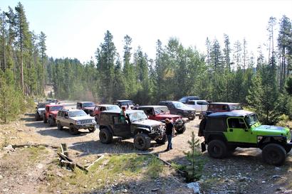 |
| 12 Rigs at the trail head |
|
|
 |
| Caruthers Lake |
|
|
|
After a full year of planning an work, we have finished the replacement of 5 condemned bridges on the McKelvey Lake Trail (also know as: North Meadow Creek Road).
Here is what Joel Sather, of the Madison Ranger District of the Beaverhead Deerlodge National Forest posted as we were finishing:
"North Meadow Creek Trail #6340 and Kid Mountain Loop #6338:
On Sunday we finished building 5 bridges. Three of the bridges are on North Meadow Creek Trail #6340, and two bridges are on Kid Mountain Loop #6338.
FYI the trail is still closed. We have crew members up there right now putting on the finishing touches. We will let folks know ASAP when it is open.
It will be soon. Please call if you have any questions.
Attached are pictures of the 5 bridges. This was a huge project. A big “THANKS” needs to go out to Montana 4x4 Association, Trail Riders Anonymous, Bozeman Mountaineers, Citizens for Balanced Use, Rory Edwards, and the Madison Ranger District Trails/Wilderness/Recreation crew.
Everyone worked their tails off:
6-8 months of emails, phone calls, text messages.
Easily 2 full days of getting all the bridge materials and rental equipment to Ennis.
2 full days of getting bridge material to the remote sites.
The Madison crew spent many days finding and then cutting down the lodgepole stringers.
Club Volunteers spent about 5 days hauling those stringers to the bridge sites.
But then after all that, we worked together to build 5 bridges in 8 days. Awesome stuff.
We had Volunteers show up that were not members of any of the Clubs. They just showed up because they wanted to help. Club members would run up after work to shuttle material and gear to the next bridge site. And if we put the call out for material needs, stuff would randomly show up and the Clubs would deliver it to the site. Amazing. Thanks everyone. Very cool project to be part of."
The photos below are by the FS.
It was an great project an probably help open this trail 5 to 7 years sooner than if left only to the resources of the Forest Service. We are definitely proud of what we accomplished.
|
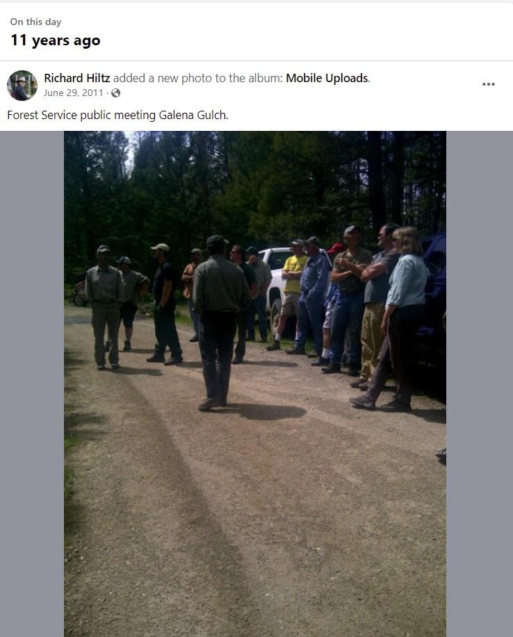 |
| Meeting with the Forest Service at the top of Galena Gulch |
|
|
This photo popped up in my memories, for June 29th, on my personal FB profile. This was a meeting of the "collaborative group" working with the Forest Service and the Beaverhead Deer Lodge National Forest from 11 years ago. I have been doing some of this for a long time now. So this was a nice reminder of when things go right, and how a little effort sometimes manages to make a difference.
The "meeting" was the Boulder River Collaborative Group get-together, at the top of Galena Gulch. There were some County Commissioners, Ranchers, Hunters, and environmentalists in the group, and me, representing the off-road community. Everyone had interests in the area, of one kind or another. The Forest Service brought biologists, foresters, and other representatives, who gave some great presentations. It was quite educational and I enjoyed learning new things.
The big deal about this meeting, for me, was that I was able to get a road closure stopped, right there, at this meeting. (Hey, I was totally surprised too!) The Ranger at the time, I believe her name was Kirsten, was explaining plans to close the North Fork of the Little Boulder Road. She was under the impression the road was seldom used and should be removed from the inventory. This made no sense to me at all as I traveled that road often.
Interestingly, with the (accidental) help of an environmentalist and the support of the county commissioners present, I was able to show it to be a very popular road, year-round, and that closing it would be an issue for many people. I really doubt this happens very often, but she pulled it off the closure list, right then and there. It is still open today.
The funny part is my best support was totally accidental. In fact, he was all for closing the road. (He is for closing almost every road.)
I was trying to explain to the ranger, just how heavily the road is used, contrary to what she had been told. Hunters, fishermen, campers...there are lots of users on that road, I was explaining.
One of the environmentalists there (who happened to have been my 6th and 7th-grade science teacher) decided to speak up. As I was making my case to the Ranger, he spoke up telling us all how he wanted the road closed due to overuse and how he and a fellow hiker had counted over 50 vehicles on a previous weekend.
I know I had a rather dumbfounded look on my face when I glanced over at him. I just smiled and said "THANK YOU!!" to him. I turned back to Kirsten and said, "like I was just saying, it is well used". Kirsten indicated it was only on the list as she was told it was a mostly unused road. She then said, "Then it is off the list". For some reason, that environmentalist, who had ridden to the meeting with me, (as I said, we know each other)...did not speak to me at all on the ride back to Boulder.
The moral of this overly long story is: You never know when and where YOU can make a difference, but as the old saying goes, "the one sure way to never win is not to try".
|
Joe and Richard made a trip out by Georgetown Lake to attempt getting to Racetrack Lake. It was touch and go for a bit due to deep drifts and occasional long sections of snow but we did make it.
We camped at Racetrack Campground. It is a beautiful spot and was close to the two trails we wanted to do this weekend. We would only manage to go to Racetrack Lake, though. We decided that Dempsey Creek, which would need to be crossed, multiple times, to get to Caruthers, would be running too high to safely cross. We were camped right next to Racetrack Creek and it just kept rising as the rain kept coming. We knew Dempsey Creek would be no better.
It was a great trip, even with all the rain. The route to Racetrack Lake, from the Georgetown Lake side of the trail, is not a hard road at all when it is dry. All the snow made it pretty exciting though. It was both our first time heading to that location.
The turnoff toward Fisher Lake, which we pass on the way to Racetrack Lake, still had very deep snow for as far as we could see. I was glad we were not heading that way.
The only bad thing is Daryl could not make this trip with us. That is a bummer, but we will get him out there soon enough.
|
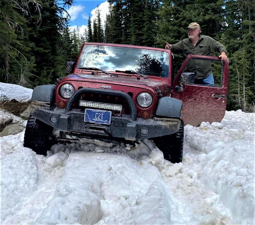 |
| Richard is stuck... |
|
|
May 8th, 2022
On Saturday, the 7th of May, Joe, Richard, and Daryl, along with some other Frontier 4x4 Club members traveled to Pipestone to join a Continental Four Wheel Drive Association (CFWDA) trail ride. The destination was Hay Canyon but they decided to go via Ringing Rocks.
Richard would end up leading the trail ride for CFWDA, due to his knowledge of the trails in the area. We had 12 rigs in all and probably 18(?) people.
I think everyone had a good time and enjoyed the trail. It was a good day.
You can find more information on the Hay Canyon Trail **HERE**
|
04/30/2022
I recently posted a nice writeup on differential lockers by Kyle Jazwiecki. It discusses what they do, what they don't do, and how they can help with certain low traction situations. Check it out. You can find it in the Off-Road 101 section or just click *HERE*
|
I just added a trail description for Noble Lake. This is not a hard trail but is a very scenic drive, just out of Sheridan Montana. It is a great trail for those looking for an exciting but not hard or dangerous ride in the mountains. And the fishing is supposed to be pretty good too. You can find it on the 4-HighTrail page or CLICK HERE .
|
FYI: With the beetle kill and the root fungus, along with these winds, traveling in Montana's forests without a saw is likely a mistake.
And no, saying you will turn around if you come across a down tree won't get it done either. More than a few times I have traveled up a trail without a problem only to have to cut my way back out later in the day. Being prepared is not just for Scouts, it is the smart thing to do.
| |
|
It's not summer around here yet but never too soon for a reminder...
More and more people are becoming familiar with these easy hand signals.
Learn how to read and to give these simple signals out on the trail.
It is about safety.
|
Just a little radio FYI:
A "TWO-WAY RADIO" is a radio that can both transmit and receive radio waves (a transceiver), unlike a broadcast receiver which only receives content (like your car stereo).
If you can talk to them and they can talk to you on your radio...it is a TWO-WAY radio. So please stop telling people you are changing "from CB to two-way radios". CB IS A TWO-WAY RADIO. So is GMRS, HAM, FRS, MURS, BUSINESS BAND, and many other radio services and their corresponding radios. When you say you are changing to "a two-way radio", those who know, know you have no idea what you are speaking of. But now you know better. 
Sorry...it's a pet peeve.  (it happens...) (it happens...)
Next, maybe a lesson on the difference between wench and winch. hahaha!!
| |
Jan. 23rd, 2022
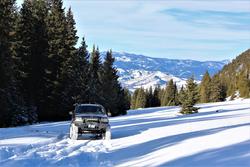
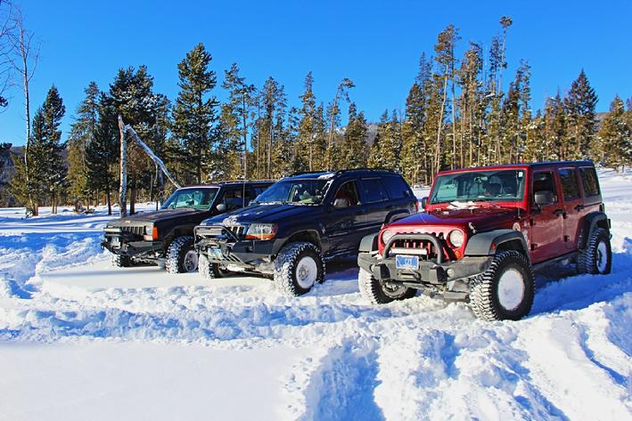
Joe, Richard, and Daryl got out for a little snow wheeling today. We headed up the Tizer Road and would make it to a drift just short of Four Corners. The lower road was pretty icy, this morning, but at about 6200 feet there was considerably more snow. It was a fine sugar-snow and was a real pain. It was a bit like driving on marbles. Even in spots with less snow, traction was a bit fleeting.
Eventually, we would locate a good spot in the sun, but out of the wind, to build a fire to cook lunch and relax for a while. Very relaxing...well, after we dug out a place for the fire and our chairs, cut up enough firewood, and collected kindling to get the fire going. THEN, it was very relaxing. HAHA!!
Pork chops, fried bologna sausage, potato salad, and chocolate pudding for dessert. It tasted great too.
As I often say...a good day of wheeling with great friends. Nice..........
|
 |
| Daryl on an icy section |
|
| |
 |
| Joe playing in a small drift. |
|
|
 |
| Three Amigos |
|
|
Jan. 1st, 2022
Joe, Daryl, and I headed out on our annual Hangover run. No, none of us were hungover...it's just a name for the trail ride on the 1st day of each year.
We did not find as much snow as we were hoping for but enough to have a good time playing in it.
We were planning on cooking lunch on the trail but the wind chill was just a tad brisk so we stopped for Pizza on the way home. lol @ zero and below, it does not take much of a wind to get the wind chill to that "tad brisk" condition.
Still, it was a great time out with good friends.
|
10/24/2021
A recent viral post running around Facebook, about how to use your phone to get help if you are lost or stuck and need help, is giving people very poor advice.
I have seen a couple of slight variations of it. Neither has actual good advice. In one variation, you have a low cell phone battery but have a signal and in another, you have a low battery and no signal.
In both scenarios, they tell people to do the same thing, change their voice mail message. One such post says:
** "PSA - If you are ever lost while hiking, get stranded with a broken down car, etc and you notice your cell phone is either low on juice or has no signal, here is a tip that very well may save your life. Change the voicemail on your phone to a message that gives your approximate location, the time, the date, your situation (lost, out of gas, car broken down, injured, etc) and any special instructions such as you are staying with the car, you are walking toward a town, etc.... The best part of this is that even if your cell phone dies or stops working, voicemail still works, so anyone calling your phone looking for you will hear the message and know where to find you or where to send help." **
I have seen everyone from 4x4 pages to search and rescue pages sharing this. Why is it "poor advice"? Easy. You must have a decent signal to access your voice mail and change the greeting. If you have enough signal (and battery life) to change your greeting, then you have enough to call 911. If you do not have a good enough signal and battery to call 911, you do not have enough to change your voice mail greeting. See the problem?
If you have enough battery but no signal, something many don't think of, try calling 911 anyway. Federal law requires all cell carriers to transmit calls to 911 regardless of what service company you have or even if you don't have a service plan at all. So, it is possible that your phone shows no signal from your carrier, but that another carrier's tower CAN get a good signal. So it is worth trying to call 911.
As for that original viral post, here is far better advice from the Skamania County Sheriff's Office Search and Rescue:
"STAY WITH YOUR VEHICLE, STAY NEAR A ROAD OR TRAIL. If you have any battery life, send a text message. It only takes a fraction of a second of data reception to get that message out. This has a much better chance to make it through than updating your voice mail.
Why is the circulated post/meme poor advice?
1. Anything using voice on your phone uses up far more battery than texts/SMS. Do not use voice if your battery is running low.
2. A detailed SMS message uses a fraction of the data that a voice message uses, and can transmit using a much weaker signal than a voice call requires. If you have a weak signal, SMS will transmit when voice will not.
3. If you don’t have a signal, you can’t change your VM. Don’t waste your battery attempting this.
What should you do instead?
If you have a signal and plenty battery-power, call 911. Be sure to have your location with GPS coordinates ready {if possible}.
But this scenario deals with low battery power and poor signal...
1. Turn off WiFi and Bluetooth and put your phone in airplane mode (or turn off cellular) to conserve power.
2. Compose a text message to all your trusted contacts. Text only - no images or attachments. Write where you are (as best as you can, bonus points for GPS coordinates!), your condition, and any info needed to locate you. It is FAR easier for a search team to locate a vehicle on a road/trail than to locate a person that has gone off into the brush. You can also text 911, but be aware that text 911 is NOT functional in all areas of the country.
3. When you are happy with your detailed text message, turn off airplane mode (or turn your cellular back on), send, and cross your fingers that your tiny text data-packet gets out to us! Outgoing texts will retry for a while if low/no signal, then cancel. Check to make sure your text went out. Moving a little to avoid hills and trees may help.
4. STAY WITH YOUR VEHICLE, STAY NEAR A ROAD OR TRAIL."
{NOTE from the OP: 911 texting is available in much of Montana. You should check on this ahead of time...it is a good thing to know for many reasons. We have had 911 texting in Lewis and Clark County, MT since 2015.}
|
10/10/2021
I decided to head south of Boulder in an attempt to get out of the smore for a bit. The Haystack Fire buring in the Little Boulder Road area up to Elk Park has had us socked in heavy smoke for months now. So I figured a trip to the Whitetail Reservoir would fit the bill. I needed a few photos for a trail discription anyway.
The plain worked. It was really clear in the Whitehall area.
I have to say that I think the Whitetail Resevoir Trail (aka Halfway Creek Road and FSR 8695 is a very underrated and under appricaited trail. It is certainly not a class 4 or 5 trail but it does have some interesting sections of larger rocks and often enough, a good bit of mud along with some small water crossings. It has more of these "interesting" sections than the much better known Hay Canyon Trail, but is in the same general area, near the Pipestone OHV Recreation Area.
If you are looking for a nice trail, consider this one. I have the trail discription posted on the facebook page and will try to have a more detailed one posted here shortly.
|
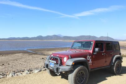 |
| This is at the Whitetail Resv. Dam. The lake was a bit low at the time. |
|
|
| 09/12/2021
Went for a relaxing ride into the Tizer Basin. I needed that. I really did. My bad attitude and I needed some alone time together. lol ~ So, I did the loop and then went to the lakes.
I took some extra time at several old mine sites. Sadly the old ore bin at the top mine finally succumbed to time and the weather and collapsed. As well, the tin building over the mine shaft just up the hill from the parking area (with the big, old, compressor) was crushed by a Beatle-killed tree. I guess everything has its time to go.
It was nice that the smoke was not so bad and there were some great scenic views. I have missed those this summer as they were always lost in the smoky haze.
|
September 4th, 2021
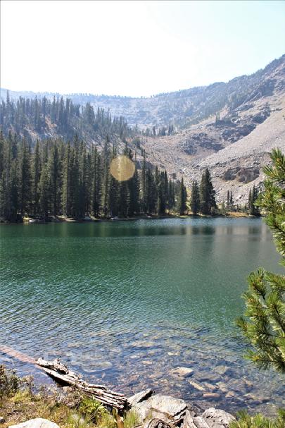
Joe, Daryl, Richard, and few friends made the trip to the trip to Dark Horse and Cow Bone Lakes. I camped in the area and the others drove in the next day for the trail. Our friend John led trail rides into this area every year for a while but some of us had not made it for a bit. I was excited to get back there. It is always a beautiful ride.
The smoke got in the way this time but even the views from the highway are amazing and they just get better as you start toward Skinner Meadows. And, both lakes are simply beautiful. Of course, early in the year, when everything is green is, of course, just crazy, but the way the area turns gold in the fall is something I find interesting and very scenic, as well.
(Photos by Richard Hiltz)
|
 |
| Dark Horse Lake |
|
|
| August 28th, 2021
Daryl and I (Richard) got an opportunity to do a trail ride with the Williston Jeeperz from North Dakota. They traveled to the Helena area for a few days of trails and fun. We joined them for their Saturday trip. This was over the Lava Mountain Trail, over to Comet Ghost Town, and then both ways through the tunnel. It was a very enjoyable and comfortable group to wheel with. The previous day, they did the Skyline Mine Trail and visited Elkhorn Ghost Town.
They were kind enough to invite Daryl and me for ice cream and a steak dinner but we had to decline. Still, a very nice offer. I wish I could have joined them for that steak though. lol
|
08/21/21
We had a great trail ride with the good folks from the Snake River Offroaders out of Idaho. We did the Hay Cayon Trail with 21 vehciles and people from the Frontier 4x4 Club, Continental 4 wheel Drive Association and MOA. We started on Whitetail Road and then went to Ringing Rocks. It was a great ride.
|
|
08/13/2021
AN UPDATE ON MCKELVEY LAKE TRAIL REPAIRS:
The following is from Joel Sather, the Natural Resources Specialist for the Madison Ranger District of the Beaverhead-Deerlodge National Forest.
Joel says:
"Hello folks. Wanted to give you an update on where we are at with North Meadow Bridges.
• One hurdle was getting an agreement in place. That can be difficult as I have to go thru our Grants and Agreements folks in the Regional Office. They are slammed. I have a back up plan of using a beefed up Volunteer Agreement. I can do that agreement in house and get your signatures and my Ranger’s signature. That may be the way we go. FYI if we go that route the agreement will speak to your donation of labor, equipment, and materials and supplies. The materials and supplies will be decking, abutment material, and hardware.
• Another hurdle is engineering support. In the way of engineered designs along with an engineer on site to supervise the building of the first bridge. Once we get those things we will have more of a green light to proceed. Please try and have patience here. Just like our Grants folks….we are spread thin. Everyone is out helping with fires which is piled on a huge workload. There are only so many engineers that cover an huge area.
• A big hurdle is finding decking. I have asked the engineer if we could cut the decking on site with a portable mill. That is one option. My advice here is to have folks scour the state, or neighboring states, for decking. Again without designs I can’t give you dimensions. And on that note if anyone finds decking, DO NOT BUY IT!!! Just try and hold it. If you find something let me know ASAP and I will contact the engineer and ask if it will work. I have heard 3” thick, 8” wide, 12’ long. This is the biggest way you can help right now….look for decking.
Hope this helps."
Just sharing our latest update from the Forest Service.
|
08/09/21
I added a discription and directions to the Skalkaho Road & Falls to the 2wd Destinations page. I recently took a really nice, but long, trip over the pass. It had been around 20 years since I had been there last and I am glad I refrshed my memories of the area.
The road is drivable with a car. There were no deep ruts or large rock in the road at any point in the 54 miles of the highway. Any crossover or SUV will really make light work of this road. The road was really well taken care of. On the Philipsberg side of the pass, I found the dirt sections were smother and better driving than the paved sections.
If you get a chance to travel this road and visit the falls, you should. Make sure you check out the "TIPS" at the end of the discription.
|
07/11/2021
Over the last few weeks, I have gotten to revisit two trails to a couple of high mountain lakes in the Tabasco Root Mountains. They are both beautiful locations at around 9000 feet. I was quite impressed by the total lack of trash on either trail. We did not see any trash on the one trail and picked up about 4 pieces along the second. I barely got to use my Trasharoo at all. I think that is great. Due to the small remote towns these trails start in, they don't get the kind of traffic ones around our bigger cities get, but the "almost" total lack of garbage is encouraging. Even the fire pits were clean. Great job to those who use those trails.
This past week we got the news that Forest Service Roads 965 (North Meadow Creek - to Twin Lakes) and 965B (New Deal Mine Road-to McKelvey Lake) were closed due to the dangerous condition of the bridges along the route. When one partially collapsed, the Forest Service sent their engineers to inspect the others, since they were all built about the same time. They found a number of them to be below safe engineering standards and issued an emergency closure order.
Multiple user groups, 4x4 clubs, and others in the off-road community, even the snowmobile community, got in contact with the forest service and offered both financial support and volunteer labor to help get these trails back open again, with as little downtime as possible.
The local District Ranger and Recreation Coordinator seem fully on-board and would like to make this happen quickly, but they are subject to the red-tape of their bosses on the State and National levels. So let's wish them luck and hope all the offers of assistance can make this happen quickly.
Of note, I am told that the Bozeman Mountaineers 4x4 Club and the Montana 4x4 Association participated in building the current bridges many years ago. Regretfully, time takes its toll and it is time to do it again. The Mountaineers are one of a number of clubs that have stepped up to offer help in putting them in again. Trail Riders Anonymous and Citizens for Balanced Use have stepped big up as well. I have seen offers of help from multiple clubs in Idaho and from all over Montana.
It is nice to see so many working together toward the goal of getting these trails reopened.
|
6/12/2021
Be safe and be prepared.
On a recent trip to the Skyline Mine, down trees were a problem. Over two days, about 20 trees had to be cut to fully open the trail. Luckily a number of groups participated in clearing the trail. Just when I had a problem with my saw, a group of SxS folks showed up and continued the work. ...very nice folks too!!
Remember that in the Helena/Boulder/Butte area the combination of a massive number beetle killed trees and that root fungus affecting large numbers of trees (even green ones) there is a lot of trees falling onto trails. Have a chain-saw, hand-saw or ax, when you go out. We know of people going out in the morning and getting blocked in by the afternoon winds knocking down a tree on their exit path. You can't always count on trees falling where you can easily winch or pull them out of the way. 
|
5/30/2021
I am working on a post about how to set proper air pressure when moving to larger than OEM tire sizes. There is a lot of bad information our there. Sometimes it seems like the vast majority of the "internet brain trust" answers and advice on this is bad. Worse yet, much of it is downright unsafe. I am still trying to figure out how to my thoughts and information on this into a formate that is understandable and helpful. Wish me luck.
|
05/22/2021
I got the chance to catch lunch with a fellow wheeler from the Kalispell area. He is a member of the Skyliners 4x4 Club, in the area. He had been in town for work but was heading home after we finished. It was an enjoyable conversation. We discussed plans for him to return later in the summer for some trail ridding. Many thanks to him for buying me lunch.
As we were talking, in come members of another club I used to wheel with a lot. He joined for a while and we discussed old times, past trail rides and some plans for future runs. Very cool.
It made for a good day with new and old friends. There is a meme out I see on Facebook from time to time that speaks of the good times and good friends made because to off-roading. Well, I resemble that remark. 
|
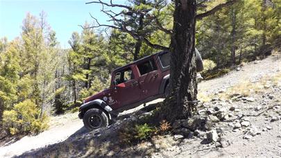 |
| The Beaverslide |
|
| 05/16/2021
I got out this weekend to do the Beaverslide Trail. The is a nice change from the normal route over Hay Canyon and intersects with it at around the mid-point of the primary Hay Canyon Trail.
I did a writeup on the route for those interested.
You can find that in the "4x4 Trail Discriptions" area.
|
Skalkaho Falls today. From 5/6/21 (photo credit: Bub Hoblitt)
You can only get to the falls from the Glendale side but that is about it just yet. It usually opens up fully around the end of May, beginning of June.
Please keep in mind that there is still A LOT of snow in the high areas. Wheel Safe!!
|
 |
| Skalkaho Falls |
|
|
Please be kind to others on the trail:
A message from us, the Forest Service, and our equestrian friends, out on the trails.
If horses are passing close to the vehicles, just shut off your rig and let them pass. It is just the kind thing to do, for the horse, for the rider, and for our reputations. Be kind and share the trail.
|
|