Quick Info:
Nearest Town: Sheridan Open Dates: July 1 to March 31
Trail Rating: Class 2.5 Length: 11 Miles (from Sheridan to lake)
High-Clearance Required?: Medium YesWide/Long Vehicles?: Thin Sections (pin stripe for full size)
Trail Type: In & out trail
|
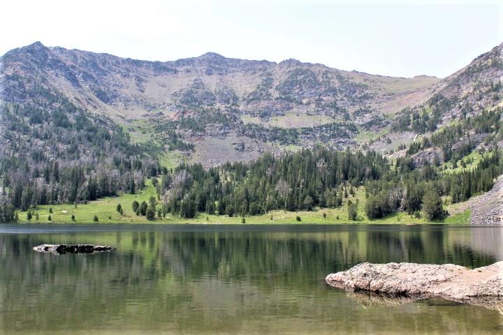 |
| Noble Lake |
|
|
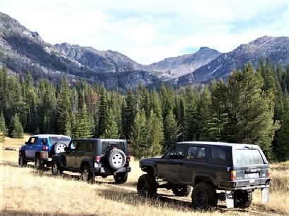
Noble Lake Trail is a beautiful drive. This is especially true, in my opinion, in the early spring and summer months when the flora and the fauna are in full bloom. It is also a relatively easy drive.
Noble Lake is 11.3 miles from our starting point just outside the Sheridan city limits. It can be traveled safely in most any medium to high clearance SUVs or trucks, as long as you do your part. The first 5.5 miles (or so) is a very well-maintained road suitable for passenger cars. Our route takes us from 5100 feet to just over 9000 feet in elevation. Most of that is during the last 5.5 miles of our trip.
|
 |
| Click for larger image |
|
|
 |
| Click for larger image |
|
|
We start on Wisconson Creek Road, just outside the north end of Sheridan on MT Highway 287. Wisconson Creek Road goes due north for about 2.2 miles and then curves to the east (right). Our drive takes us another 3.2 miles where we will take a right onto Noble Fork Road, aka FSR 8300. About a mile after turning onto Noble Fork Road, you will need bare to the left, crossing Noble Fork Creek. I have found that many maps do not show this spot accurately, so be aware of that.
|
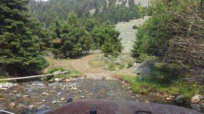 |
| Crossing Noble Fork Creek |
|
| |
 |
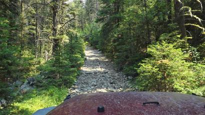
| About as rough as it gets |
|
|
 |
| One of the bumpy spots |
|
|
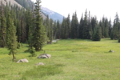
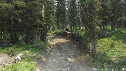
From the turn from Wisconson Creek Road, onto Noble Fork Road, it is almost exactly 6 miles further to the lake. This is where the "trail" portion of the trip starts. There are few side-roads so it is pretty easy navigation. Just go until you see the lake. There are plenty of rocks in the road to make it a bit rough and also a couple of steep sections, but it is doable in 2wd...however, 4wd is easier on the environment, so please keep that in mind.
|
 |
| Noble Fork Road |
|
|
|
Google Maps pins:
Intersection of Hwy 287 and Winsconson Creek Road, just outside of Sheridan: CLICK HERE
Intersection of Winsocnson Creek Road with Noble Fork Road: CLICK HERE
|
NOTE: We are simply describing a 4x4 route. We accept no responsibility for your decisions. 4x4 off-roading can be great fun but it can also be dangerous. People can get hurt and vehicles can get stuck and/or damaged. Trail conditions can, do, and will, change at any time. Road conditions may no longer be accurately reflected in this or any trail description. Only you can decide what trails or obstacles your experiance and vehicle can safely navigate. When in doubt, turn around. Wheel Safe!!
|
|