 |
| The view of Beaver Creek Canyon from the trail |
|
|
Quick Info:
Nearest Town?: York Yearly Closure?: Oct. 15 to May 15
Trail Rating: Class 3.5 Length?: 5.7 Miles (24 mile full loop)
High-Clearance Required?: No Wide/Long Vehicles?: Thin sections!!
Type?: Loop
|
There is a lesser-known but exciting trail just outside of York, Montana, that I think many of you may find some interest in. Locally, we refer to it as "The Back Way To Hogback". Officially, it is the Cottonwood Road or Forest Service Road 4155. It is not a long trail. It is only about 5.7 miles long, but it has a way of seeming longer. I promise it will not leave you feeling bored. The trail takes you from Nelson Road to the communications site at the top of Hogback Mountain. Cars and crossovers need not apply for this one.
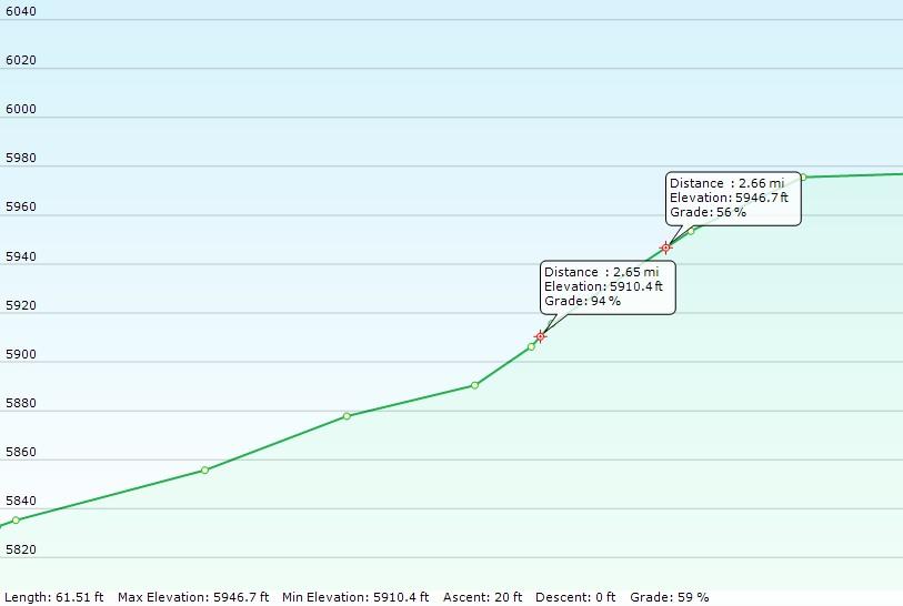
So what makes it so exciting? That would be the many VERY steep sections of this trail. My GPS recorded quite a few hills at 40% and 50%+ grades with two exceeding a 94% grade. To give you an idea of just how steep that is, a 100% grade is 45 degrees. Trust me, that is STEEP on a shale and gravel-covered road! You go from 4140 ft to over 7800 ft in just 5.7 miles.
|
I rate the trail as Class 3.5. (See our trail classification system: HERE) It does not have large rocks to crawl over and you do not need large tires or particularly high clearance for this trail. But, I highly recommend at least one locker due to the very steep sections of trail, often on loose shale. It is thin in many places. Not just pin-stripe thin but a physically thin road. It will NOT be very friendly to particularly wide or long vehicles and will make them work for it...hard. This trail is not a place for old carburated rigs either. The angles tend to be too much hill for too long, and fuel problems are very likely.
This trail can, of course, be done as a loop when you include the Beaver Creek Road through the canyon back to Nelson and then York. I will show a link to directions for that route below (when finished). Of course, the Back Way To Hogback can always be the backway FROM hogback if you run it that way. haha!
|
Ok, on to the directions:
Take the Nelson Road, going north, out of York. You can find a Google Maps pin to York, Montana here: YORK MONTANA
There are two ways to enter this trail. I am using the one that is both the easiest to find and follow and offers less conflict with campers and shooters who are often along the other route. It also gives us one more nice hill to warm us up for what is to come.
Follow Nelson Road for 6.4 miles to Cottonwood Road, aka Forest Service Road 4155. It will be a right-hand turn and the FS has it marked at that intersection. There is a small study area (fenced trees) there too. You can find a Google Maps pin to this intersection here: FSR4155
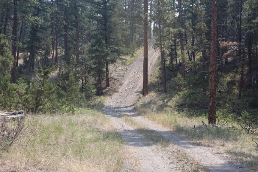
Follow Cottonwood Road / FRS 4155 through the gate. Keep going until you come to a fork in the road. Then take the right-hand fork. You should see this trip's first steep hill by then. Go up the hill and just keep following the road. You will drive past a section Jack-leg fence (on the left) put there by the Forest Service. That used to be the trail but is no longer used. So don't let an old map throw you off here. Keep going straight until you come to a T in the road (at the rise of a small hill). We are going left and up that big hill.
|
 |
| The first hill |
|
|
NOTE: At the time I am writing this, there is a road closed sign someone attached to a tree, right before the steep hill here. That sign does not apply to either the trail you are heading up or where you just came from. Forest Service Road 5144 is open to full-size vehicles from 05/16 to 12/01. It is covered by the Helena-Lewis and Clark Nation Forest MVUM (click for a link) Big Belt Mountains MVUM (2016).
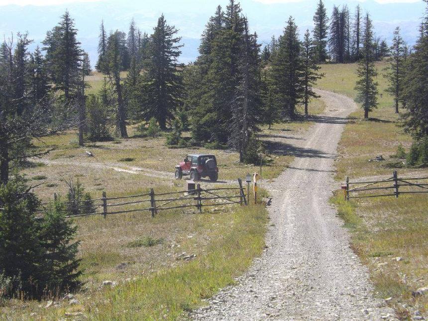
From here, the trail is really easy to follow. Just stay on the road. Until you get almost to the top, there are no intersecting roads to take a wrong turn on. As you get close to the top, you will come to a T in the road where FSR 4155 meets FSR 298. Take the right on FSR 298. (left will take you to a turn around). A little further, up FSR 298, there will be another fork. Both directions take you to the communications site at the top of Hogback, so either way works. The right fork is the most direct, the left fork offers some additional views of the Beaver Creek Canyon below.
|
 |
| Just some sample slope grades on this trail |
|
|
You should now be at the old Forest Service's Hogback fire tower and the antenna site for KTVH TV, some radios stations, and a few others. The fire tower sits at 7812 feet. On a clear day, you can see a very long way from here.
Now you just have to decide if you turn around and go back the way you came or keep going down the other side, across Indian Flats and then to the Beaver Creek Road, Nelson, and then back to York via the Nelson Road. This route is well marked, easy to follow, and generally suitable for Crossovers and SUVs.
So there you have it. The Back Way to Hogback is sure to bring a little excitement to your off-roading.
|
 |
| The last fork before the fire tiwer |
|
|
Tips: This is not a good trail for anyone's "first off-road adventure". You "NEED" to air down (for traction more than for the bumps), and you really should have at least one locker for this trail. I have seen it done without any of that, and it was not pretty to watch.
Wheel Safe!!
Trail Description by Richard Hiltz
|
NOTE: We are simply describing a 4x4 route. We accept no responsibility for your decisions. 4x4 off-roading can be great fun but it can also be dangerous. People can get hurt and vehicles can get stuck and/or damaged. Trail conditions can, do, and will, change at any time. Road conditions may no longer be accurately reflected in this or any trail description. Only you can decide what trails or obstacles your experience and vehicle can safely navigate. When in doubt, turn around. Wheel Safe!!
|
|