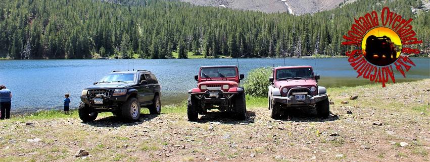
| Boulder Lakes (Madison County) |
Quick Info:
Nearest Town: Twin Bridges Open Dates: ALL
Trail Rating: Class 2.5 Length: 15.3 Miles (from Twin Bridges)
4.5 Miles of FS Trail
High Clearance: Yes Wide/Long Vehicles: No Concerns
|
For more information on the trail rating system we use: CLICK HERE
|
The Boulder Lakes are a beautiful destination. Due to the good condition of the road, it is an excellent choice for those who wish to get into the high back-country but are not looking for a harder 4-low type off-roading experience.
It is not a trip for a car, but with a bit of skill and some careful driving, most modern SUVs, with true 4-wheel-Drive, can make this trip with little difficulty. The trail is also full-sized friendly. It is bumpy (baseball sized rocks) in more than a few spots, with larger rocks along the last 4.5 miles, so I highly encourage airing down for this road. You may not need 4-wheel-drive. Use it anyway. It is easier on your vehicle and the trail.
The Boulder Lakes ARE a true wild place and above 8400 ft of elevation. Be prepared for high mountain weather and always be bear-aware! On our last trip to these lakes, we got to watch a bald eagle fishing in the lower lake and spotted a beautiful cinnamon-colored black bear and her cubs. We were told we just missed some mountain goats too. We could see sign from all sorts of deer and elk, as well. So there is a lot of wildlife in this area. There were fish, jumping at flies, in the lakes.
Do yourself a favor, make sure you remember the bug spray or you may slap yourself to death before you get back off the mountain.
|
 |
| Joe, Daryl, and Richard |
|
|
It is a pretty easy trail to follow. So let's get to that.
While there is another way to access this trail, I am starting my description in the monopetalous of Twin Bridges, Montana. This way is easier to find and follow.
We start on Main Street in Twin Bridges. Depending on which way you are coming from, it's also MT Hwy 41 or Hwy 287. They meet almost at our starting point. We will be turning east onto 3rd Avenue. Lucky for us, you can't turn the wrong way here as 3rd Ave. only goes to the east. (Note: some maps even call it "East 3RD Avenue".) 3rd Avenue turns into Bear Gulch Road, right about the city limits and after a little less than a mile.
( For a Google Maps PIN to the Main Street/3rd Ave intersection in Twin Bridges: **CLICK HERE** )
|
 |
| Click for larger image |
|
|
Follow Bear Gulch Road 8.4 miles (from Twin Bridges), to just before the entrance of Bear Gulch Canyon. Then turn left onto Dry Boulder Road.
|
After turning left onto Dry Boulder Road, which is really just a two-track road, the road will make three sharp curves before finally entering public lands. if you have not done so already, there is a good spot for airing down about 1/4 mile after you hit public lands. (If you air-down, I recommend doing so in or just out of Twin Bridges (preferred) or waiting until on public lands to avoid potential landowner conflicts)
You are now only 4.5 miles from the lower lake. There are few side roads to worry about taking a wrong turn on. Just follow the main road.
That's it. It is a pretty simple place to find.
I was impressed with how clean the trail was last I was there. I can only hope you will help keep it this way. The area around the lakes is wild, sensitive, and beautiful, so PLEASE keep it this way - TREAD LIGHTLY!
Trail description by Richard Hiltz
|
 |
| Click For Larger Image |
|
|
NOTE: We are simply describing a 4x4 route. We accept no responsibility for your decisions. 4x4 off-roading can be great fun but it can also be dangerous. People can get hurt and vehicles can get stuck and/or damaged. Trail conditions can, do, and will, change at any time. Road conditions may no longer be accurately reflected in this or any trail description. Only you can decide what trails or obstacles your experience and vehicle can safely navigate. When in doubt, turn around. Wheel Safe!!
|
|