| Independence Trail & Blue Lake |
Quick info:
Nearest Town?: Big Timber, MT (48 Miles) Open Dates?: Year round
Class: 3 Length?: 9.3 Miles (Trailhead to Blue Lake)
High-Clearance Required?: Yes Wide/Long Issues?: Wide Vehicles = Caution
Type?: Same way in & out
|
 |
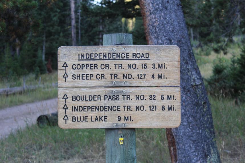
| Trailhead Sign |
|
|
Independence Trail is an amazing destination. This trail is all about the scenery and views. The trail is in a thin corroder which is surrounded by the Absaroka-Beartooth Wilderness. It is a very wild place. Keep that in mind. This is grizzly country.
The trail itself is not particularly difficult but not boring. I rate the trail a Class 3 trail. ( for our trail rating system: CLICK HERE ) I do not recommend it for soft-roaders or crossovers. While you may not require 4x4, you may need high clearance and low gears. There are some spots that may get a bit thin for full size rigs and some pinstripe is pretty much guaranteed.
|
A bit of History
Gold was first found in the area of Basin Creek in 1864, when that portion of Montana was still part of the Crow Indian Reservation. By 1888, the mining boom was in full force. The Independence, Hidden Treasure, and Daisy mines along with many smaller operations bored into the steep sides of Independence Mountain. The Independence Mine site is at almost 10,000 feet.
At one time, there were about 500 men and women working in the general area but its altitude and climate made mining difficult. Eventually, there were two general stores, four saloons, two gambling halls, one post office, a restaurant, and a hotel there. By 1893, the mines had yielded about $42,000 in gold bullion. But due to poor management and transportation, this boom was short-lived.
A fire distroyed the only local gold mill in 1904 and that would be the beginning of the end for Independance. It was just too far and too difficult to haul ore to more distant mills.
|
 |
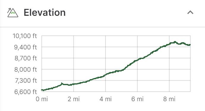
| Elevations from trailhead to Blue Lake parking area |
|
|
Getting there:
The directions are not difficult but they do start about 48 miles from the trailhead, in Big Timber, Montana. Then, from the trailhead to the parking area before Blue Lake is another 9.3 miles. So, for those with small fuel tanks and/or really poor fuel mileage, a 120 mile (or so) round trip from Big Timber, together with the low mileage of off-roading, may be an issue. So, for some, a bit of additional fuel may be an important consideration.
Note: There are two exits into Big Timber from I90. The western exit is 367. The eastern exit is 370. In both cases, you turn north at the exits and get onto Big Timber Loop Road (US Highway 191) and head into town. At the intersection of Big Timber Loop Road (US Highway 191) and McLeod Street (MY Why 298), turn south. When you leave Big Timber, McLeod Street (MY Why 298) changed names to Main Boulder Road.
From here it is pretty simple. Stay on the Main Boulder Road (MT Hwy 298) for about 48 miles, until you come to the trailhead and parking area. You WILL know when you get there.
From the trailhead, getting to the Independence area and Blue Lake is just as easy. Get on the trail and keep going until you get there. That will be about 9.3 miles to the Absaroka-Beartooth Wilderness border close to Blue Lake. Keep in mind, there is some private land along the way and even some active mining. Please respect private property.
Google Pin to Big Timber Loop, McLeod Street intersection: CLICK HERE
Google Pin to Independence trailhead & parking area: CLICK HERE
My Gaia GPS track to Blue Lake (shown on map below): CLICK HERE
|
 |
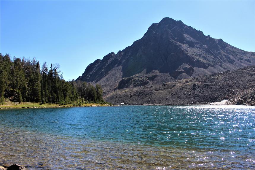
| Blue Lake |
|
|
NOTE: We are simply describing a 4x4 route. We accept no responsibility for your decisions. 4x4 off-roading can be great fun but it can also be dangerous. People can get hurt and vehicles can get stuck and/or damaged. Trail conditions can, do, and will, change at any time. Road conditions may no longer be accurately reflected in this or any trail description. Only you can decide what trails or obstacles your experience and vehicle can safely navigate. When in doubt, turn around. Wheel Safe!!
|
|