| Little Boulder River Road Trail |
Quick Info:
Nearest Town: Boulder Yearly Closure?: None
Trail Rating: Class 3 Length: 9.5 Miles from the Jeff Co. Fairgrounds
High-Clearance Required: Yes Wide/Long Vehicles: Width Concerns (one spot)
Trail Type: Same In/Out
|
The Little Boulder River Road is a nice trail. You could take a 2WD truck with average clearance about half the way. However, at that point, the road gets a little bit steeper and the thin cut the road goes into has some larger rocks to climb. From that point on, the trail gets much rockier and more interesting. Most people who travel this road stop and turn around at that cut as it looks a bit intimidating to many none off-roaders. Not us, of course, but many do.
This is a Class 3 trail during the summer months so is appropriate for most 4x4 truck or Jeep type vehicles. This is an interesting trip along the Little Boulder River. It is a one way in/out trail (well, mostly) and most off-roaders will stop at or around the old Sheils and Ironsides mine (by the pond) which is about 9.5 miles from our start at the Boulder Fairgrounds.
|
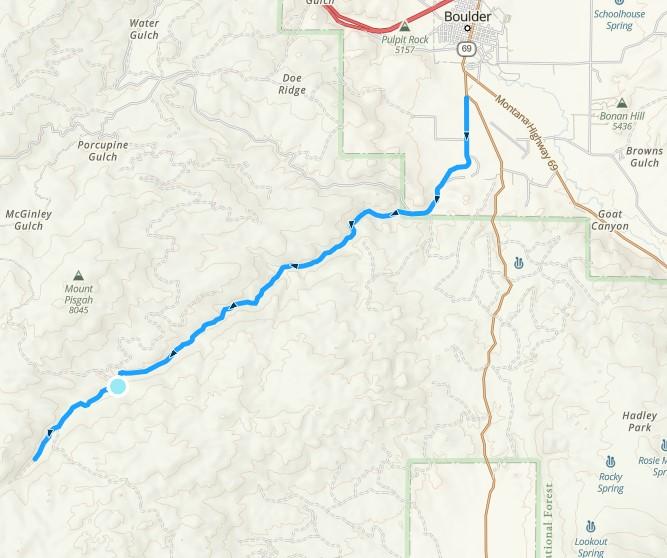 |
| The Little Boulder Road To the Shields and Iron Side Mines |
|
|
There are a few camping areas that might be used to drop a truck and trailer, early on the trail but only if not occupied. So, it may be best if trailers are left at the Boulder Town Pump Property (with permission, of course).
Our road starts about 1/4 mile south of Boulder via Montana HWY 69. From Boulder, the turn to the Boulder River Road is a right (south) at the Jefferson County Fairgrounds. The fairgrounds, if not busy, is a good spot for airing up/down but not for leaving trailers. After passing the fairgrounds, you should stay to the right. (NOTE: going left is the Whitetail Road) From there, just stay on this main road. The pavement only lasts about another 1/2 mile and you will cross into Forest Service lands after another mile more or so.
From that first fork in the road, it is a pretty easy trail to follow. Just stay on the main road.
|
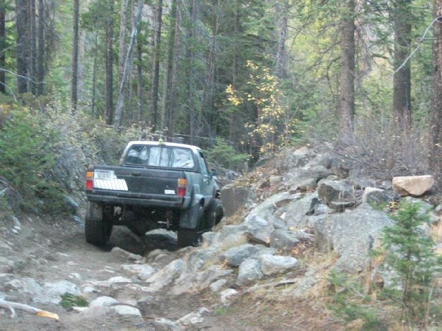 |
| Part of "The Cut". It is not a big deal. |
|
|
There are, for all practical purposes, only 4 side roads or forks, on the entire trail, after entering Forest Service land.
The first fork, after entering FS land, is to the left and most people will not even notice this well-camouflaged route. The next fork is to the right. This is the North Fork of The Little Boulder Road and goes up to Galena Gulch.
|
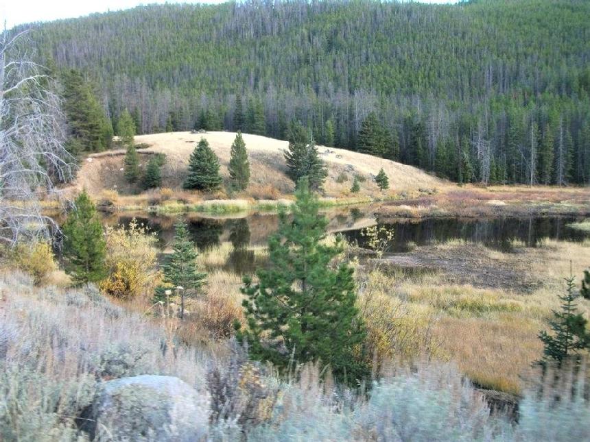 |
| The pond at the Shields and Iron Side Mines |
|
|
Further up the trail, there is another fork at a green cabin. This fork to the right goes to Forest Service Road 8675 (the Eureka Mine) and is a closed road. Our route bares to the left here. The final fork is just before the outlet for a pond on the old Sheils and Ironsides mines property. (This left heads to the Big Major Mine and is not a recommended trail. You may not even notice it as you pass.) The road only goes about 2 miles more, though most people only go about a mile past the pond.
|
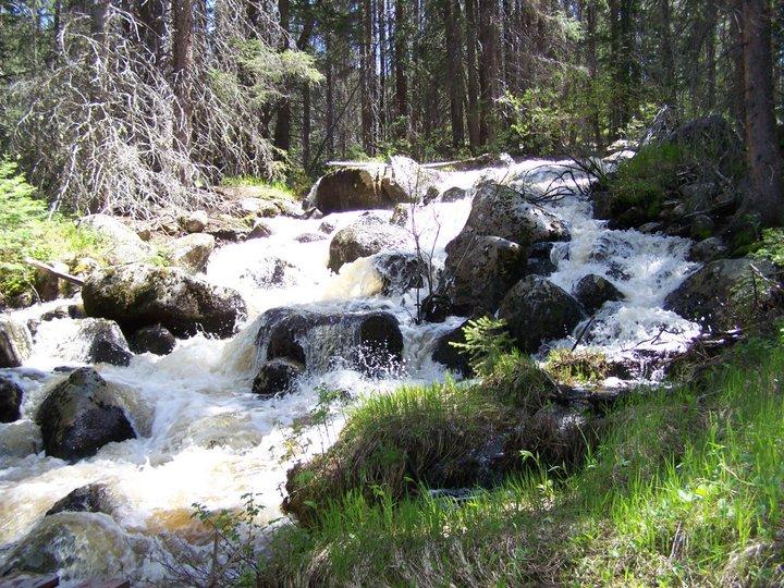 |
| The Little Boulder River w/Spring runoff |
|
|
That's it. Pretty painless, huh?
Please do not damage the small shack or other buildings next to the road by the pond. It is private property and belongs to a friend.
LINK FOR FOREST SERVICE MVUM: **CLICK HERE**
|
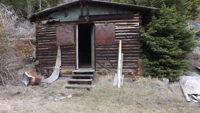 |
| LARRY'S CABIN (THIS IS PRIVATE PROPERTY SO PLEASE BE NICE) |
|
|
NOTE: We are simply describing a 4x4 route. We accept no responsibility for your decisions. 4x4 off-roading can be great fun but it can also be dangerous. People can get hurt and vehicles can get stuck and/or damaged. Trail conditions can, do, and will, change at any time. Road conditions may no longer be accurately reflected in this or any trail description. Only you can decide what trails or obstacles your experiance and vehicle can safely navigate. When in doubt, turn around. Wheel Safe!!
|
|